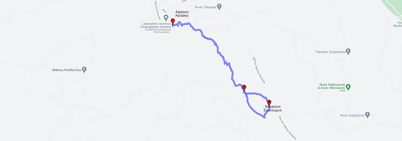
Agiasos (Agios Ioannis) - Agios Konstantinos - Astratgos - Panagiouda - Sanatorium

| General description: |
Hiking trail through rural landscapes and forested areas with pine trees, cultivated olive groves, chestnut trees, heather, and orchids. |
| Detail description: |
On the hiking trail that starts from Agiasos, there are four chapels: "Agios Ioannis," "Agios Konstantinos," "Astratgos" (Archistrategos-Taxiarchis), and "Panagiouda" (Birth of the Theotokos). The location of ancient Penthilis is defined by Astratgos, up to Panagiouda. It had inhabitants until 1701, when it was abandoned due to tax exemption in Agiasos, and today only the crops on terraces remain. The trail ascends through orchards with fruit trees and chestnut trees until it reaches Panagiouda and enters a pine forest. A small loop can be made towards the Sanatorium, where the asphalt road passes towards Agiasos and Megalochori. |
| Transportation means: |
Car and bus to Agiasos |
| Accessibility: |
Asphalt access to Agiasos, Sanatorium |
| Best season: |
Annually |
| Places to visit: |
|
| Signage: |
Yes |
| Route starting point: |
Agiasos |
| End of Route: |
Agiasos |
| Type of tourism: |
Nature-loving, walking/hiking, cultural |
Points of interest
Agiasos (Agios Ioannis)
| Name: |
Agiasos (Agios Ioannis) |
| Description: |
Settlement |
| Category: |
View |
| Longitude: |
39,080558 |
| Latitude: |
26,371542 |
| Altitude: |
400 |
Agiasos was created where the monk Agathon the Ephesian built his hermitage. He came from Jerusalem to Lesbos during the period of iconoclasm (803 AD), carrying with him an icon of the Virgin Mary and other sacred treasures. According to the prevailing opinion today, the name of the village comes from the inscription on the icon of the Virgin Mary that Agathon brought from Jerusalem, "MOTHER OF GOD HOLY ZION". The settlement of Agiasos is characterized as a traditional settlement with an urban character (continuous building system) and with little or no yards, according to the Presidential Decree 19.10/13-11-1978 (FEK 594/D/13-11-1978). The settlement develops around the church of Panagia, and all the main roads lead to it. As the roads converge towards the center from the periphery of the village, they meet at acute angles, which is a characteristic feature of Agiasos. The cultural collections of Agiasos, hosted in the Folklore Museum, are noteworthy.
Panagiouda
| Name: |
Panagiouda |
| Description: |
Church/Monastery |
| Category: |
Cultural elements |
| Longitude: |
39,070485 |
| Latitude: |
26,384165 |
| Altitude: |
600 |
Graphic chapel - a resting point with dense vegetation and a view of the slopes of Mount Olympus, there is a fountain with drinking water in the location.
Sanatorium
| Name: |
Sanatorium |
| Description: |
Nursing facilities |
| Category: |
Cultural elements |
| Longitude: |
39,069034 |
| Latitude: |
26,388738 |
| Altitude: |
640 |
In 1924, tuberculosis had spread to large segments of the population and was one of the main causes of death. The State began exploratory efforts to select a suitable location for the establishment of a sanatorium in Lesbos. All government officials adopted the idea that the Sanatorium should be established in the location of "Svyrnio Tagari". The significance of this location selection for Ayassos became apparent in the following years and until today the "YGEIA" Sanatorium continues to be a fundamental infrastructure project in the field of health and care.
The route
